
Results of search are displayed as a grid as well as on the right panel.
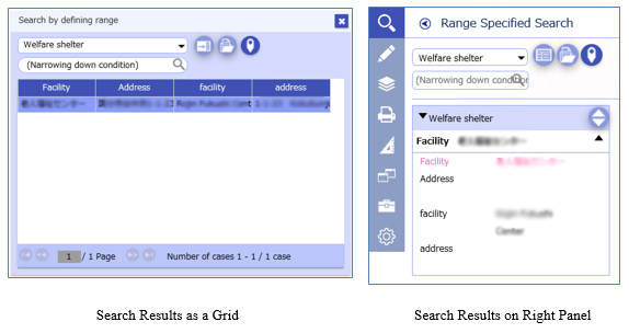
Common to grid and right panel
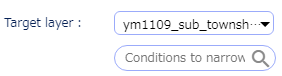
Select the layer for which you want to display search results.
You can also select "All" on the right panel.

You can narrow down the search results.
Enter the words and click on the  buttons or click Enter key to narrow down
the search results.
buttons or click Enter key to narrow down
the search results.
 |
Filing viewClick to toggle between On and Off. |
 |
Fit to selected featuresClick to toggle between On and Off. |
 |
Print search results as a listPrint the search results. |
Grid
 |
Show on right panelDisplay in the right panel Display search results in the right panel. |
Right panel
 |
Grid viewDisplays the search results as a grid. |
 |
Sort view switchShow or hide the search result sorting settings. 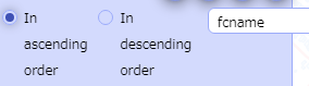
By this switch, you can choose sorting order and sorting target field. |
Display attributes of the features existing within the specified area.
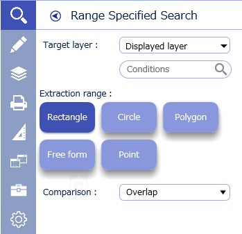
The layer subject for search.
Search area type
 |
RectangleDrag on the map to specify a rectangular area. |
 |
CircleDrag on the map to specify a size of a circle. |
 |
PolygonSpecify a size of polygon with the points you clicked on the map as the vertex. |
 |
Free formSpecify a size and shape by a trajectory of a cursor you move on the map. |
 |
PointClick on the map to specify the point on the map. |

Select a buffer search condition.
Display the coordinates typed in or of the position on the map clicked.
You can save the list of searched coordinate values in CSV format.
You can confirm the position of the coordinates listed in CSV file on the map.
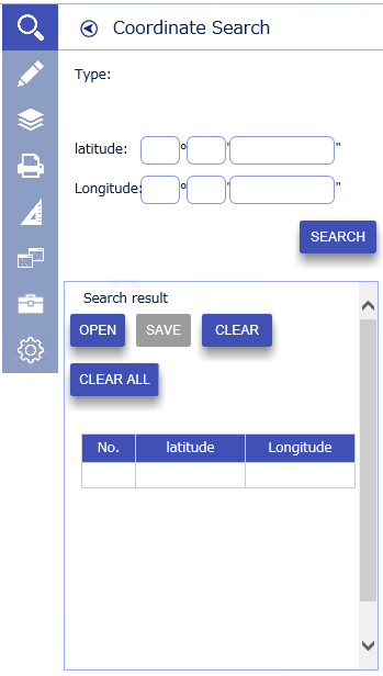
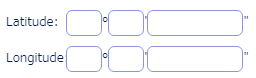
Latitude Coordinate and Longitude Coordinate or X-Coordinate and Y-Coordinate.

Performs a search.
 |
OpenOpen the CSV file of the coordinates. The coordinates listed in the opened file are displayed in the list of search results. |
 |
SaveOutputs the search results to a CSV file. |
ClearClear the selected record among the search result. |
|
Clear AllClear all the search results. |
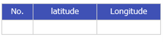
Displays the coordinate search results as a grid.
For direct input of the coordinates
Choosing a Coordinate Position on a Map
Search attribute information of the features on the target layer based on the search conditions.
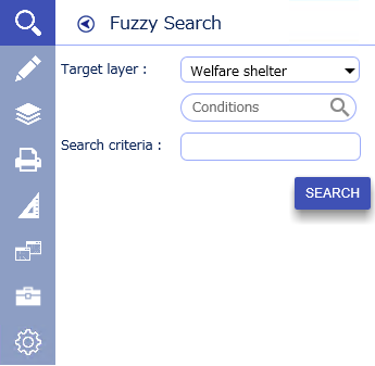
Select the layer you want to search.

Specifies the search criteria for fuzzy searches.
Performs a search.
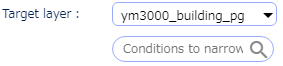
Select the target layer.
Enter a search condition
(Even if the search condition is empty, the search can be performed).
Click the Search button.
The search result is displayed in a way explained in 4.1.1 Features common
to every search mode.
* If the search criteria is empty,
all attribute information for the selected target layer is displayed as a search
result.
Find the approximate location from the address, and display the corresponding location on the map.
* Controls vary depending on the setting.
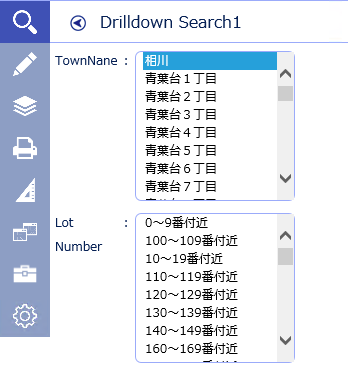
Select TownName and lot number.
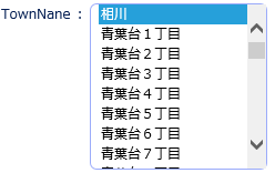
Name of “TownName” to be searched.
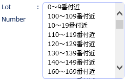
Lot number to be searched
Performs a search.
* The map fits the narrowed results.
* You can also search for TownName from Katakana search.
Search for the target from the entered name.
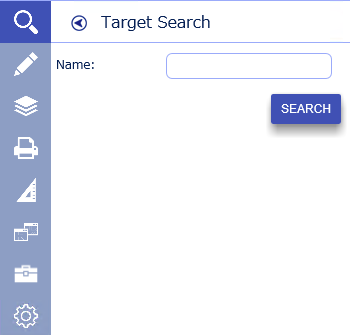

Specify the name of the land mark to be searched.
Performs a search.
* If the name of the landmark is empty,
all the landmark will be displayed as a search result.