
Measurement on a map.
* Measurement is on GIS environment,
so please treat the measured value as a reference only.
They should not be used forany official estimation or calculation.
 |
DistanceShow the distance between clicked points.* Minimum 2 points are required. Double-click to fix the measurement. Right-click to display the context menu. |
 |
Distance (curve)Shows the length of the trajectory of a cursor on the map. |
 |
AreaDisplay the area and the length of the outline of a polygon created by clicking points on the map.* Minimum 3 points are required. Double-click to fix the measurement. Right-click to display the context menu. |
 |
Concentric circleCreate a concentric circle centered on the clicked position.* The concentric circle settings are described separately. |
 |
DeleteAll the figures created for the measurement are deleted. |

Select the thickness of the outline of concentric circle.
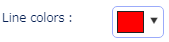
Choose the color of the outline of the concentric circle.
Choose color by using a color map or by entering RGB value.

Enter the radius of the concentric circle (in meter).

Select the number of concentric circles.

Enter the radius of the smallest circle of the concentric circle (unit: meter).

Sets the transparency of concentric circles.
Specify the transparency by using a scroll bar or entering a value in the text box.